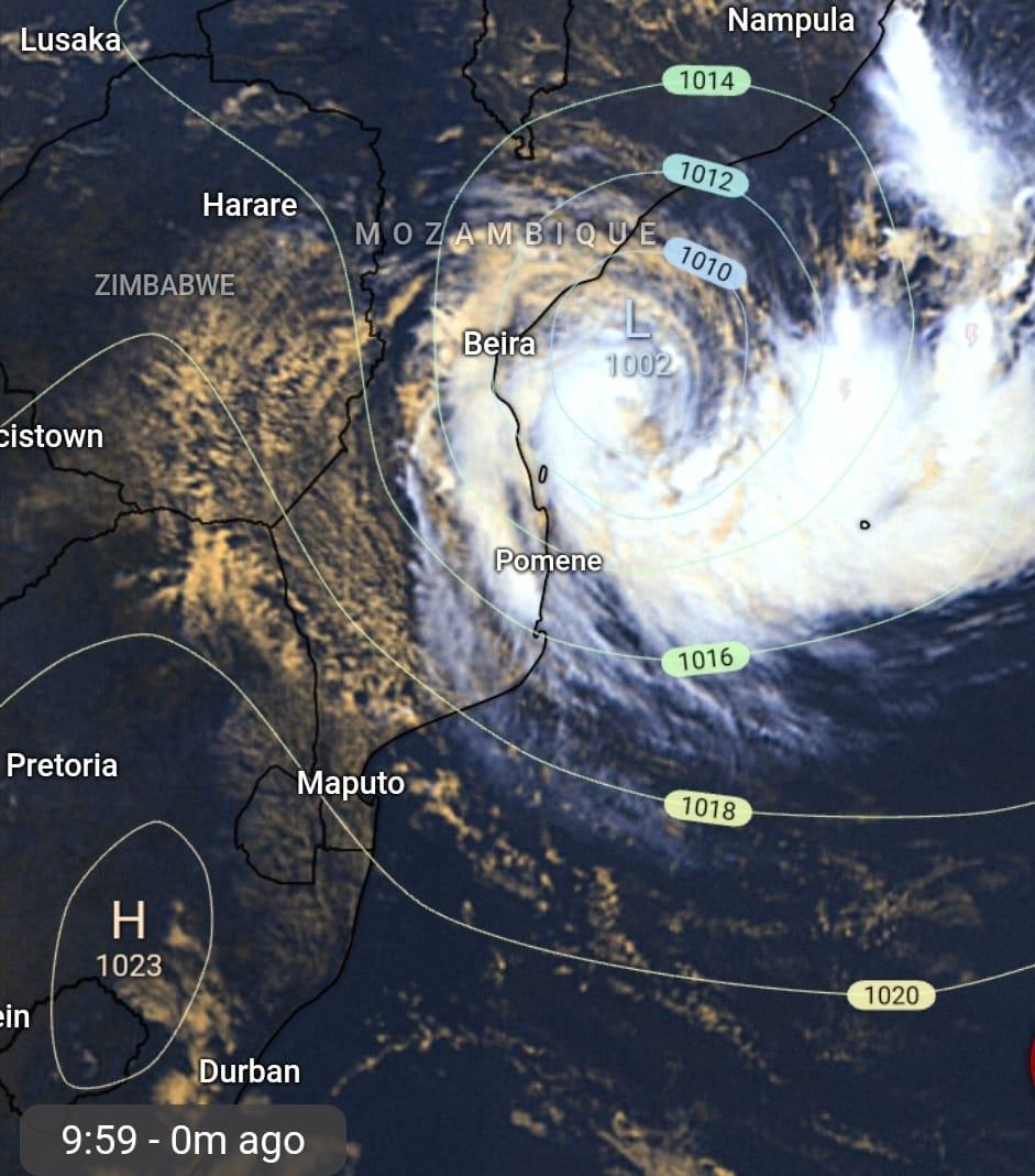
Filipo, a moderate tropical storm firmly entrenched in the Mozambique Channel, is expected to reach the intensity of a strong tropical storm by the end of today (Monday).
The eighth tropical storm of this season, Filipo’s maximum winds averaged over 10 minutes are 75km/h, with estimated maximum gusts of 100km/h as at 8am this morning.
ALSO READ:
Filipo is on a west then southwest trajectory and is expected to make landfall late Monday night going into Tuesday morning between the extreme south of Sofala province and the north of Inhambane province.
According to the Regional Specialised Meteorological Centre (RSMC), strong, locally destructive winds accompanied by heavy rain, as well as a deterioration in sea conditions, are expected in the southern provinces of Mozambique today.
Image: SWAICSA/Facebook
Mozambique’s National Institute of Meteorology on Sunday issued a red warning pertaining to Filipo and advised residents of affected areas to adopt precautionary and safety measures.
The SA Weather Service (SAWS) has not issued an update since Sunday, when it said northern KZN, and the lowveld regions of Mpumalanga and Limpopo could expect ‘a spell of windy, rainy weather in the period between Tuesday and Thursday this week’.
HAVE YOUR SAY
Crédito: Link de origem


Comentários estão fechados.